Wednesday, November 18, 2015


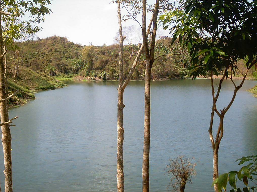
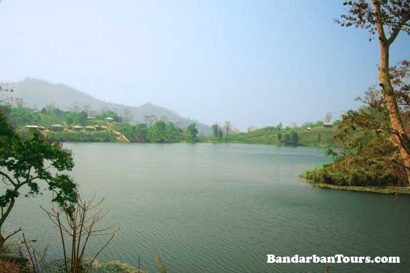
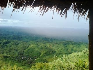
Kaptai Lake: This large man made lake of Bangladesh spanning over an area of approximately 11000km2, was created as a reservoir when the Kaptai dam was built during the 1960s. The lake was created by flooding valleys and plain lands between numerous hills. This created a picturesque view as forested hills and plateaus rise from beneath the water. The government run tourism corporation and private operators offer Kaptai Lake Cruise Tours, which is worth of it. Other scenic spots are also accessible through the waterways.

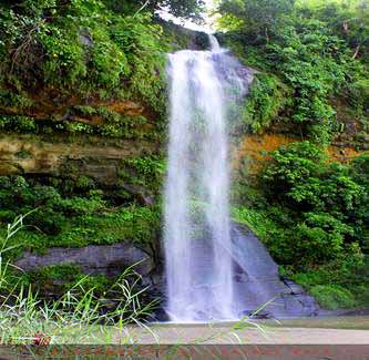
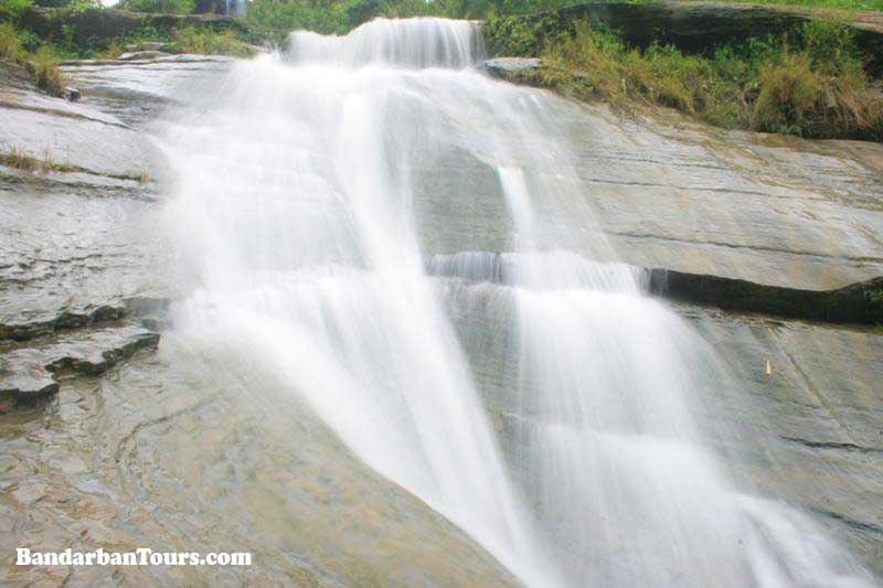
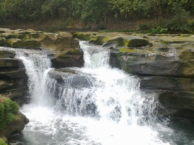
Shuvolong Falls: Shuvolong a place in Borokol sub district, located about 25kilometers (11kilometers – as the crow flies) away from Rangamati. There are few waterfalls in Shuvolong area with the largest one falling from as high as 300 feet. In the past several years, this place has turned into a tourist destination due to beautiful waterfalls and the nearby market. Shuvolong is easily accessible by speed boat or motor boats from Rangamati.

Tribal Museum: The museum is located near the entry point to the city. Established in 1978, it is run by the Tribal Cultural Institute. Traditional ornaments. costumes, potteries, musical instruments, armaments, paintings and photographs, old manuscripts, statues and ancient coins of various tribes are on display here. It is open Saturday to Thursday excluding public holidays.

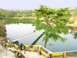
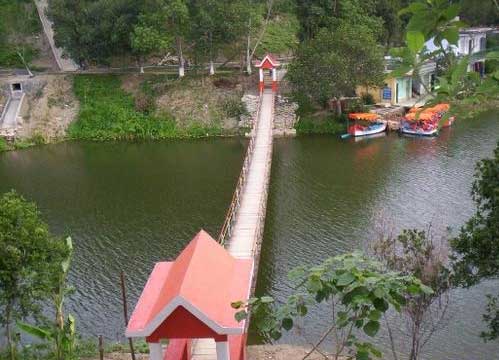
Hanging Bridge: This 335feet long bridge across a portion of the Kaptai lake is an icon of Rangamati.


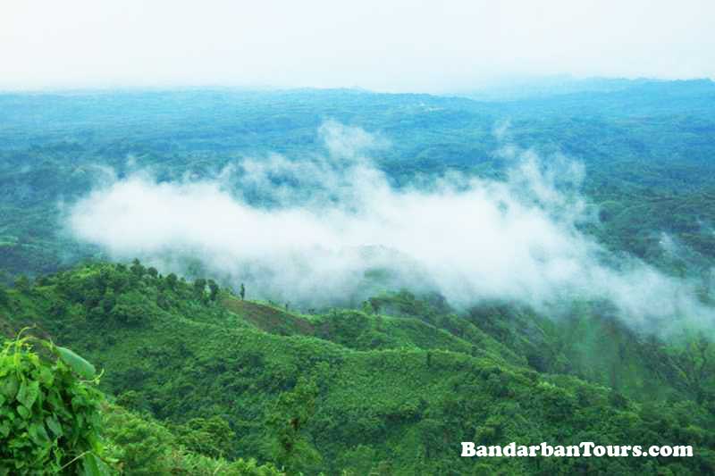
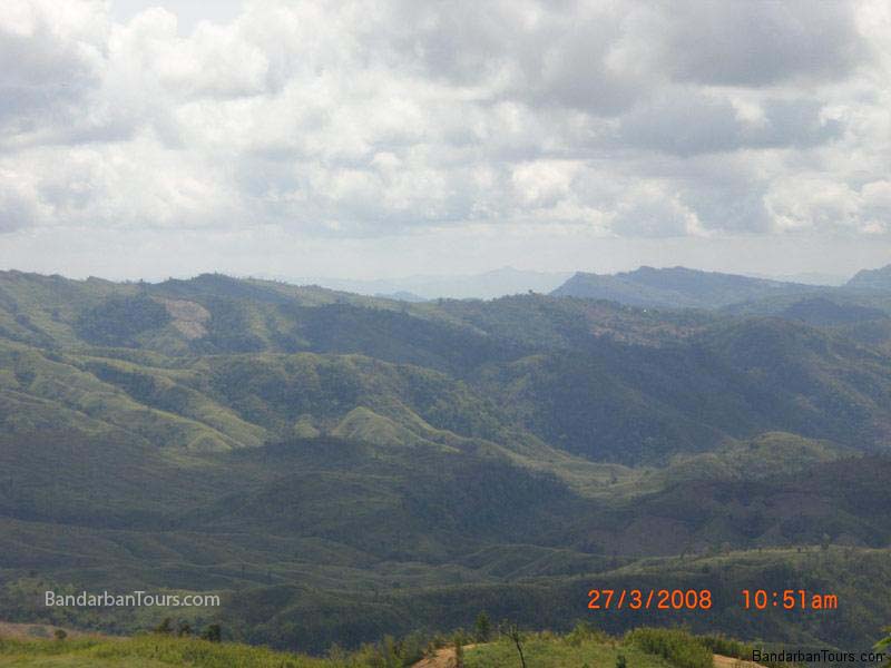
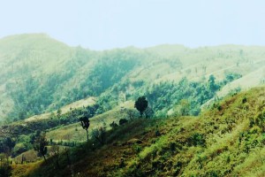
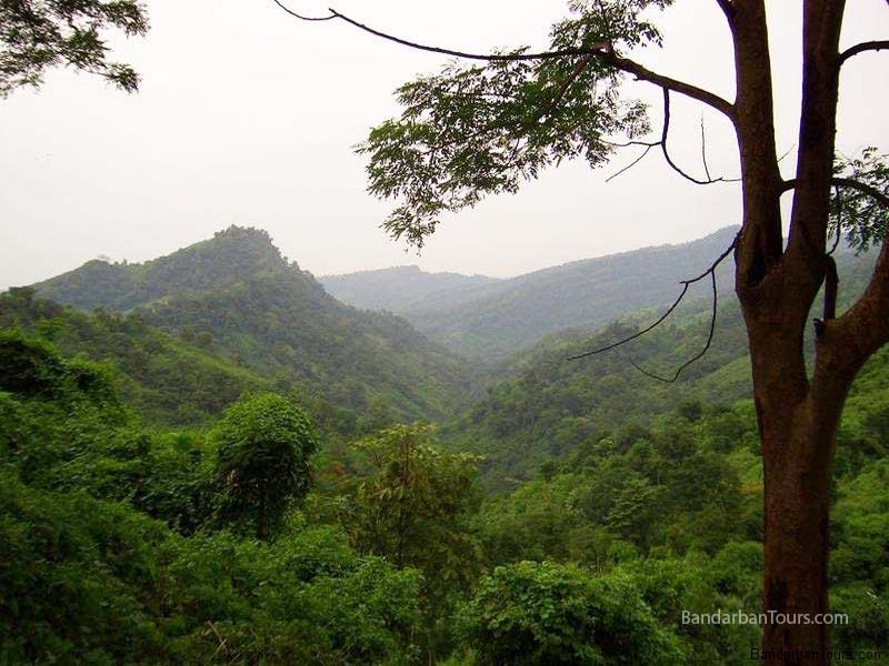
Kaptai National Park: This forest reserve is located in the Karnafuly and Kaptai range. According to the government statistics some 50,000 people visits the national park every year as it provides some walking trails among the lush green forest. The animal species of Kaptai National park are deer, elephants, monkeys, fishing cats and birds. The Kaptai Forest Rest house, Kaptai Mukh Forest Rest House and several picnic spots are located here.

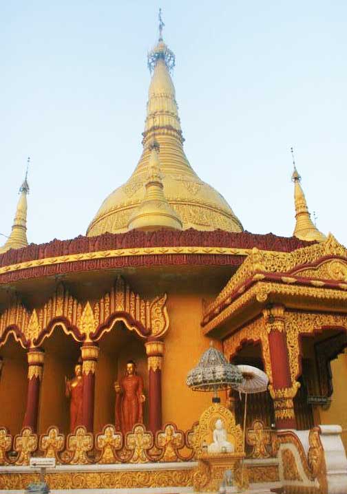
Rajban Bihar Pagoda: An internationally known Buddhist Temple, where the spiritualist principal monk of Rajban Vihara, Shrimath Sadhana Nanda Mohasthabir(Ban Vante) lives.

Peda Ting Ting: A small island on the Kaptai Lake, few kilometres away from Rangamati. It is mostly known for its serenity. There are a few tourist accommodation facilities here and a tiny restaurant run by the locals. It offers foods ranging from traditional to indigenous delicacies.

Chakma Royal Palace: This is the palace of the present Chakma King. However, it is open to public for a visit.

DC Bungalow Area: The District Commissioner’s Bungalow is located adjacent to the lake. There is a small light house and a shelter accessible to the public. This spot provides a nice view of the lake.

Others: The local market is also a tourist attraction as it offers handicrafts, textiles and ornaments made by the tribal people.

Rangamati and Bandarbans are diffrent district in the division of Chittagong in Bangladesh. These two district are full of natural beauties and thats amke this country beautiful Bangladesh.


Rangamati, a small town located amongst the green hills, lakes and rivers of the Chittagong Hill Tracts. This is what makes it a prime Bangladesh hill destination. It is known as the Lake City of Bangladesh as this place is located on the bank of the beautiful Kaptai Lake. It is the administrative headquarter of the Rangamati Hill District, the largest district of Bangladesh and located some 77 kilometres away from Chittagong. For long time Rangamati has been a prime Bangladesh tourist destination for its location, scenic beauty, colourful tribal people, tribal homespun textiles and ivory jewellery.

Rangamati is situated in the Chittagong Division. It is surrounded by the Tripura state of India to the north, Bandarban District to the south, Mizoram State of India and Chin State of Myanmar to the east, and Khagrachari and Chittagong Districts to the west.

The area of the district is 6116 km2 of which 1292 km2 is riverine and 4825 km2 is below jungle vegetation.
Tourists attractions in Rangamati: 


Nilgiri and Thanchi: Nilgiri or Nil Giri or Neelgiri is one of the tallest peaks and beautiful tourist spots in Bandarban, Bangladesh. Nilgiri is about 3500 feet high and situated at Thanchi Thana of Bandarban district in Bangladesh. Nilgiri is about 46 km south of Bandarban on the Bandarban-Chimbuk-Thanchi road. Beside this Nilgiri spot travelers and tourists can also roam around the Mro villages. Their colorful culture and living style are surely an unexplored experience for the visitors and tourists. More…


Prantik Lake: Prantik Lake is really a beautiful tourist spot in Bandarban district of Bangladesh. Prantik lake of Bandarban is surrounded by many kind of plants and trees. This amazing place – Prantik Lake will certainly attract tourists minds. Prantik Lake is an ideal place for travel. Prantik Lake located in a village named “Holudia” near the Keranihat-Bandarban Road. Prantik Lake is 14 kilometer away from Bandarban town. Volume of this Prantic Lake area is 29 acres. More…


Rijuk Waterfall: Rijuk waterfall (Rijuk Jhorna) is located at Ruma upazilla of Bandarban district, Bangladesh. The water of Rijuk waterfall continuously falls into the river Sangu from about 300 feet high hill with beautiful sound throughout the year and this water is shiny like pearl particles in the space creating a unique beauty of nature. Rijuk waterfall is surrounded by different kind of plants and underwood. More…


Sangu River: Sangu River is the complete part of the natural beauty of Bandarban, Bangladesh. Sangu river follows a northerly circuitous course in the hill tracts up to Bandarban, Bangladesh. Sangu river enters the Bandarban district from the east and flows west across the Bandarban district and finally falls into the bay of Bengal at the end of a course of 270 kilometer. Sangu river is flowing through the hills for thousands of years. More…


Shoilo Propat: The waterfall named Shoilo Propat or Shoylo Propat at Milanchari, Bandarban, 4 km from the town on the road to Thanchi from Bandarban town. Shoilo propat is also an excellent site, maintained by Bangladesh Parjatan, the national tourism promotion corporation of Bangladesh. More…


Tajingdong: Tajingdong, also known as “Bijoy” is the highest mountain of Bangladesh. Tajingdong is about 4300 feet (1310 meters) high from the sea level of Bangladesh. Tajingdong is situated in remakri pangsha union under Ruma upazilla of Bandarban in Bangladesh. According to local tribal language “Tajing” means “Great” & “Dong” means “Hill” so that means “Great hill”. More…


Upabon Parjatan: Upabon Parjatan is another beautiful tourist spot in Bandarban at Naikhongchari, Bangladesh. Upabon Parjatan is a wonderful gift of nature. Here is an amazing lake surrounded by forest. A lot of birds are singing here and tourists will surely be amazed by looking at the big rocks and surrounding natural scenes. At Upabon Parjatan, there is a hanging bridge over the lake and it is longer than the Meghla hanging bridge of Bangladesh.


Meghla Tourist Spot: Meghla Parjatan Complex is one of the most amazing tourist spots for the travelers and tourists coming from all over Bangladesh and world. Meghla is in the contiguous area of the Bandarban hill district council on the gateway of Bandarban, maintained by Bandarban district administration. More…


Nilachal Tourist Spot: There is another beautiful place to see near Meghla, which is called Nilachal, maintained by Bandarban district administration. Nilachal is known as tiger hill. The view of Nilachal is so spectacular for snapping. Nilachal is the nearest tourist spot from Bandarban town, Bangladesh. Nilachal is situated at Tigerpara. Nilachal is near about 2000 feet above the sea level and 5 kilometer away from the Bandarban town. More…


Mirinja Parjatan: Mirinja tourist spot (Parjatan complex) is situated at Lama upazilla of Bandarban district in Bangladesh. Mirinja is a wonderful tourist spot in Lama, Bandarban. Mirinja is about 1500 feet high from the sea level of Bangladesh. In good weather, travelers and tourists can see the Maheskhali Island, Bay of Bengal, Matamuhuri River and Lama upazilla at a glance. More…


Nafakhum and Remakri: Nafakhum is one of the most beautiful waterfalls in Bandarban, Bangladesh and an excellent place to travel. Every traveler should have a tour plan to visit this beautiful tourism spot of Bandarban, Bangladesh at least once and then they will feel to visit that travel spot again and again. Nafakhum is situated on the wild hilly Sangu River at a remote area called Remakri of Thanchi upazilla More…

Boga Lake: Boga Lake is the most beautiful natural lake in Bandarban, Bangladesh. It is also known as Bagakain Lake or Baga Lake. Boga lake is 18 kilometer away from Ruma Sadar Upozilla in Bandarban, Bangladesh. The area of Boga lake in Bandarban is about 15 acres. Boga lake is situated at about 3000 feet above sea level of Bangladesh. The color of water of this Boga lake is blue and very much eye catching. There are many mythological stories behind the creation of Boga lake. More…


Buddha Dhatu Jadi: The Buddha Dhatu Jadi is a Theravada Buddhist temple known as the Bandarban Golden Temple. The Buddha Dhatu Jadi is located at Pulpara, 4 kilometer from Balaghata town and 10 kilometer from the remote Bandarban hill district in Bangladesh. The Bandarban Golden Temple is the largest Theravada Buddhist Temple with the second largest Buddha statue in Bangladesh. More…


Chimbuk Hill and Tribal Villages: Chimbuk hill is the third highest mountain in Bangladesh. Chimbuk is one of the most familiar tourist spots in Bandarban, Bangladesh. Chimbuk hill is just 26 kilometer away from Bandarban sadar. Chimbuk hill is about 2500 feet high above sea level of Bangladesh. The road of this area is zigzag. So if a traveler rides in a jeep it will be adventurous and charming. While the jeep will be moving through the various indigenous villages of Bandarban, Bangladesh, More…


Keokradong: Keokradong is the second highest mountain of Bangladesh. Keokradong is about 4,035 ft (1,230 meters) high from the sea level of Bangladesh. It is situated at 30 kilometer away from the Ruma sadar upazilla of Bandarban, Bangladesh. This remote area is full of natural beauty. Here the travelers and nature lovers can see many small and big mountains and hills. Keokradong is covered with dense forests, birds and animals. More…

Beautiful Bangladesh

Bandarban- The natural Beauty of beautiful Bangladesh

Bandarbans- the another beauty of Bangladesh:


Bandarban Hill District is the remotest and least populated district in Bangladesh. The lure of the tallest peaks of Bangladesh, treks through virgin forests and chance to meet more than 15 tribes of the region up close is growing both among Bangladeshis and tourists from other countries.


Bandarban, a 4,479 km² wide area with a population of 292,900 (2003 est.) inside Bangladesh is bordered by Cox’s Bazaar, Chittagong, Rangamati and Khagrachari. On the other side of the 129 kilometer international border lies Myanmar provinces of Chin and Arakan.

Bandarban has only one town that approaches anything near a city – the Bandraban town. The rest of the area is divided into 7 upazilas, which are in turn divided into varying numbers of unions. Each union is a cluster of paras and villages.


Tourists spots in Bandarban in Beautiful Bangladesh: 

  • Baklai Waterfall
  • Boga Lake
  • Buddha Dhatu Jadi
  • Chimbuk Hill and Tribal Villages
  • Chinri Jhiri Waterfall
  • Faipi Waterfall
  • Jadipai Waterfall
  • Keokradong
  • Meghla
  • Mirinja Parjatan
  • Nafakhum and Remakri

  • Nilachal
  • Nilgiri and Thanchi
  • Patang Jhiri Waterfall
  • Prantik Lake
  • Raj Vihar and Ujanipara Vihar
  • Rijuk Waterfall
  • Sangu River
  • Shoilo Propat
  • Tajingdong
  • Upabon Parjatan
  • Zingsiam Saitar


Cox's Bazar (Bengali: কক্সবাজার Kaksbājār)

Is a town, a fishing port and district headquarters in Bangladesh. It is one of the world's longest uninterrupted natural sandy sea beaches, The beach in Cox's Bazar is an unbroken 125 km sandy sea beach with a gentle slope. It is located 150 km south of the industrial port Chittagong. Cox’s Bazar is also known by the namePanowa, whose literal translation means "yellow flower." Its other old name was "Palongkee".

The modern Cox's Bazar derives its name from Captain Hiram Cox (died 1799), an officer serving in British India. An officer of the British East India Company, Captain Cox was appointed Superintendent of Palongkee outpost after Warren Hastings became Governor of Bengal. Captain Cox was specially mobilised to deal with a century-long conflict between Arakan refugees and local Rakhains. He embarked upon the mammoth task of rehabilitating refugees in the area and made significant progress. A premature death took Captain Cox in 1799 before he could finish his work. To commemorate his role in rehabilitation work, a market was established and named Cox's Bazar ("Cox's Market") after him.

Bangladesh is the land of nature because she is full of natural beauties. InBangladesh there are many attractions for the tourists around Cox’s Bazaar district. Inani beach is one of the most attractive and charming land. During the holiday many people even the students come to the place to enjoy the natural beauty. Actually Inani beach is famous for the rock and coral boulders; you will find big coral boulders in this beach. It is only 32 km from the main Sea-Beach.


Today, Cox's Bazar is one of the most-visited tourist destinations in Bangladesh. It has yet to become a major international tourist destination, and has no international hotel chains, due to lack of publicity and transportation. Recently, the Bangladesh Government formed the Tourist Police unit to better protect local and foreign tourists, as well as to look after the nature and wildlife in the tourist spots of Cox's Bazar.


You can plan a trip to Inani beach via Himchory for a half day or may be a full day sightseeing. The way to go Inani beach from cox’s bazar is full of mind blowing scenes of nature. The green hills stay in the east of the road and in the west the ultimate beauty of Bay of Bengal. Everybody become strange because the scene is very amazing, your mind will be with full of charm even before seeing Inani beach. All kinds of seashells are found on this beach with variation of colors and sizes. Tourists like to come here for relaxing and enjoying as it is free from the crowd of visitors who are typically seen at the Laboni beach.


Coxs Bazar is a district under Chittagong division in Bangladdesh. There is one of the longest sea beach in world. It is a continuous 125 km sandy sea coast with a gentle slope.
History and Background


The name Coxs Bazar has come from Captain Hiram Cox. He was appointed as a superintendent of Palongkee at the time of British India in 18th century. The town is 6.85 square km, and bounded by Bakkhali River on the north and East, Myanmar on the east, Bay of Bengal in the West, and Jhilwanj Union in the south. Main tourist season is November to February. Postal Code is 4700 and NWD Code is 0341.
Upazilas and Thans


There are eight upazilas under this district, namely:
Chakaria Upazila
Coxs Bazar Sadar
Kutubdia
Maheshkhali
Ramu
Teknaf
Ukhia
Pekua
Transportation and Communication


There are three type of transport communication with Dhaka. That is bus, train and road. Bangladesh Biman, United Air, Regent and Novi Air have there flight. By air it takes 60 minutes time. There is luxury bus service with Dhaka. By train, passengers need to go first Chittagong g and then by bus. It is 154 km from far from Chittagong.
Hotels and Accommodations


There are lot of hotels near by the sea shore. They are 5 star to budget hotel. Among them hetel Seagull, Sea Crown, Nilima Resort are popular. Bangladesh Parjatan Corporation has their won complex there. Sea fishes are available there. Alcohol is not are available.
Nearest Tourist Spots


Kolatoli beach
Kolatoli beach is another attractive beach for the tourist.It is near the main hotels in Coxs Bazaar.


Laboni Beach
Laboni beach is considered as the main beach area of Coxs Bazaar as is at the central location and close to town.


Enani Beach
Inani beach is famous for its golden sand. Located about 32 km to the south of the famous tourist destination of Coxs Bazaar


Himchari Waterfall
Himchari is one of the most attractive places for the visitors. Beautiful Waterfall. Located 12 km south of Coxs Bazaar Town and 6 km from the Kalatali beach by the hill.


Ramu Coxs Bazar
About 10 km from Coxs Bazar, is a village with a sizeable Buddhist population.


Saint Martins Island
Saint Martins is the only coral island in Bangladesh, approximately 9 km south of the tip of the Coxs Bazar-Teknaf peninsula.


Teknaf
It is about 100 km far away from Coxs Bazar.This is the only place Bangladesh which is connected with Myanmar by a small river called Naf River of Bangladesh.


Radar Station
It is constructed by Japan under the overseas development agreement. It is also called hilltop radar station.


Rubber Dam
rubber dams in the Bakkhali River and Idagaon Khal in Coxs Bazaar district that would supply irrigation water to 8,000 hectares for rice cultivation.


Aggmeda Khyang Monastery
A large Buddhist monastery, and a place revered by around 400,000 Buddhist people of Coxs Bazaar and the Chittagong Hill Tracts. The main sanctuary is posted on a series of round timber columns.


Dulhazra Safari Park Chakaria
Dulahazra Safari Park was developed on an undulating landscape of around 2,224 acres of area at Chakaria Upazila in Coxs Bazar District, wild elephants which are native to the area.


Moheshkhali Island
Moheshkhali is a jewel among the attractions of Coxs Bazaar. The island is famous for its beauty and tranquility. Numerous eager rickshaw pullers patiently wait for the arrival of tourist, and offer them an exclusive tour of the island.


Sonadia Island
Sonadia is a small crescent shaped island. 7-km north-west of Coxs Bazar.The sight of game birds migrating Sonadia Island in huge numbers through the winter seasons.